IMMAGINI RELATIVE AI MIEI MESSAGGI
per il FORUM FILATELIA e FRANCOBOLLI pagina 116
FORUM CONTINUA 116: Qui parleremo delle isole SAMOA, sia della parte USA che delle Western Samoa ora indipendenti. (Parte del commento lo lascio in inglese per gli amici di "Pacifica")
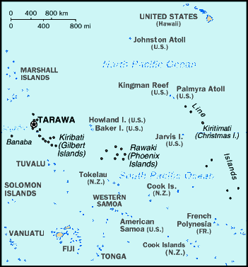
Siamo nel Pacifico centrale:
inquadriamo il Pacifico con l'arcipelago delle Samoa
questa mappa chiarisce un po' le posizioni delle isole del Pacifico Centrale, Tahiti è lì nella French Polynesia.
background Samoa Western o indipendenti:
New Zealand occupied the German protectorate of Western Samoa at the outbreak of World War I in 1914. It continued to administer the islands as a mandate and then as a trust territory until 1962, when the islands became the first Polynesian nation to reestablish independence in the 20th century. The country dropped the "Western" from its name in 1997.
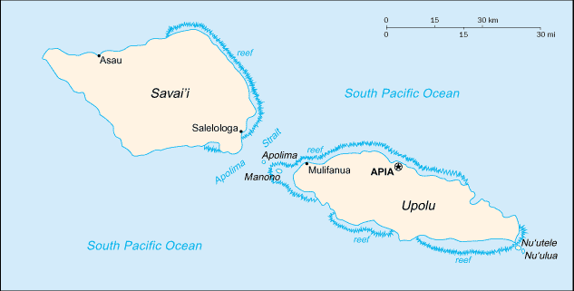
Samoa indipendente formata da due isole maggiori: Savaii e Upolu
Oltre ad Savai'i e Upolu ci sono varie isolette fra cui Matautu (allargo di Upolu) e Tuasivi fra le due isole maggiori.
background Samoa Americane:
Settled as early as 1000 B.C., Samoa was "discovered" by European explorers in the 18th century. International rivalries in the latter half of the 19th century were settled by an 1899 treaty in which Germany and the US divided the Samoan archipelago. The US formally occupied its portion - a smaller group of eastern islands with the excellent harbor of Pago Pago - the following year.
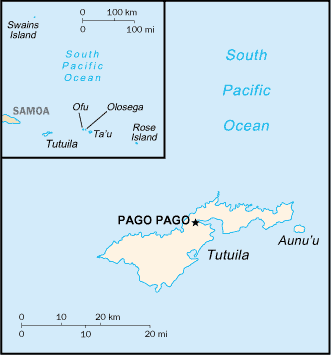
American Samoa: composte dalle isole Tutuila con la capitale Pago Pago, Ofu, Olosega, Ta'u, Aunu'u, la lontana Rose island (è un piccolo atollo) e dall'isola di Swains che geograficamente fa parte delle isole Tokelau (dip. N. Zelanda)
Scendiamo in dettagli:
SAMOA INDIPENDENTE (ex Samoa tedesche, un tempo Western Samoa, o Samoa i sisifo)
Samoa, officially the Independent State of Samoa, is a country comprising a group of islands in the South Pacific Ocean. Previous names were German Samoa from 1900 to 1919, and Western Samoa from 1914 to 1997. It was recognized by the United Nations on 15 December 1976 (UN members) as Samoa. The entire group was known as Navigators Islands before the 20th century because of the Samoans' excellent seafaring skills. It has a population of 176,710 (2001 census).
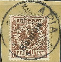
Apia- Samoa Tedesca
As Germany began to show more interest in the Samoan Islands, the United States laid its own claim to them; Britain sent troops to express its interest. There followed an eight-year civil war. Each of the three powers supplied arms, training, and in some cases combat troops, to the warring Samoan parties. All three sent warships into Apia harbor, and a larger-scale war seemed imminent, until a massive storm damaged or destroyed the warships, ending the military conflict. At the turn of the twentieth century, the Treaty of Berlin split the Samoan Islands into two parts: the eastern group became a territory of the United States (the Tutuila Islands in 1900 and officially Manu'a in 1905), and are today known as American Samoa; the western islands, by far the greater landmass, became known as German Samoa after the British gave up claims to the islands in return for Fiji and some Melanesian territories. New Zealand troops landed in 'Upolu on 29 August 1914 and seized control from the German authorities; after that, the western islands became known as Western Samoa.
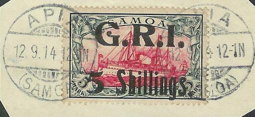
Occupazione alleata delle Samoa tedesche
From the end of the Great War (World War I) until 1962, New Zealand controlled Samoa as a Class "C" Mandate under trusteeship through the League of Nations, followed by the United Nations. Though never a member of the British Commonwealth, it enjoyed many benefits through its relationship with New Zealand. The Western Samoans began a campaign known as the Mau ('Opinion') to protest the foreign administration, claiming mistreatment of the Samoan people and blaming outsiders for the death of a fourth or fifth of the population during the Spanish flu pandemic, which ravaged the western islands and much of the world in 1918. (A prompt quarantine by authorities in American Samoa spared the eastern islands.) In 1962, Western Samoa became the first Pacific Island state to regain its independence. In many ways though, it remains closely tied to New Zealand.
In July 1997, the constitution was amended to change the country's name from Western Samoa to Samoa. Samoa had been known simply as Samoa in the United Nations since joining the organization, in 1976. The U.S. territory of American Samoa protested the move, asserting that the change diminished its own identity. American Samoans still use the terms Western Samoa and Western Samoans to describe the independent State of Samoa and its inhabitants. While the two Samoas share language and ethnicity, their cultures have recently followed different paths, with American Samoans often emigrating to Hawai'i and the U.S. mainland and adopting many U.S. customs, such as the playing of American football and baseball. Western Samoans have tended to emigrate to New Zealand, whose influence has made the sports of rugby and cricket more popular in the western islands.
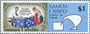
Western Samoa o Samoa i isifo 1980
Geography:
The country is located east of the international dateline and south of the equator, about halfway between Hawai'i and New Zealand in the Polynesian region of the Pacific Ocean. The Samoas are of volcanic origin, and the total land area is 2934 km², consisting of the two large islands of Upolu and Savai'i which account for 96% of the total land area, and eight small islets: Manono, Apolima, Nu'utele, Nu'ulua, Namua, Fanuatapu, Nu'usafe'e, and Nu'ulopa. While all of the islands have volcanic origins, only Savai'i has had recent eruptions and could be considered volcanically active: the last major eruption occurred in the 1700s, and smaller eruptions occurred in the first decade of the twentieth century. The highest point in Samoa is Mauga Silisili, at 1858 m. The main island of Upolu is home to nearly three-quarters of Samoa's population, and its capital city is Apia. The climate is tropical, with an average annual temperature of 26.5 °C, and a rainy season from November to April.
Samoa è composta da due isole: Savai'i e Upolu oltre ad alcuni isolotti di modeste dimensioni. Lo Apolina Strait divide le due isole principali. Le città principali sono Apia (la capitale), Mulifanua, Salelologa e Asau; tutte quante non superano i 40.000 abitanti.
Samoa (anche: Samoa occidentali in lingua locale Samoa i sisifo) ) è uno stato dell'Oceania, composto da un gruppo di isole dell'Oceano Pacifico meridionale. Le isole occupano 2.944 km2, e contano 178mila abitanti circa (nel 2004). La capitale è Apia. In precedenza vennero chiamate Samoa Occidentali dal 1914 al 1997 e Samoa Tedesche dal 1900 al 1919.
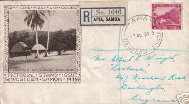
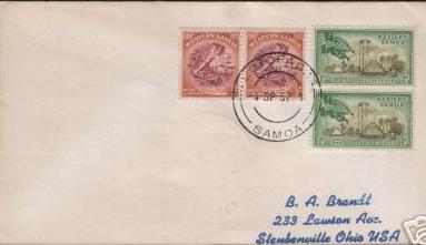
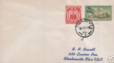
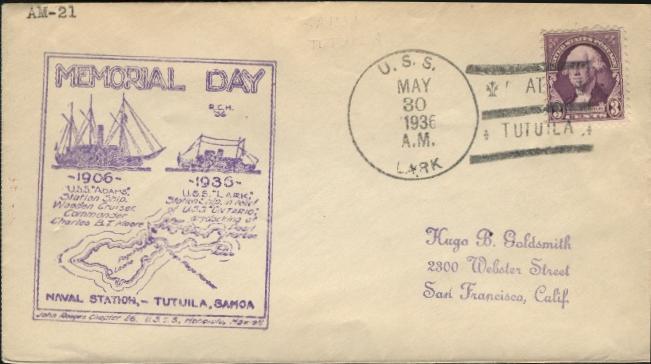
e già che ci siamo ecco una cover 1935 di Apia capitale delle Samoa (isola di Upolu)
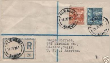
Falealili nell'isola di Upolu Samoa
Falefa nell'isola di Upolu Samoa
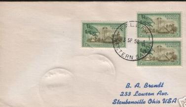
Leulumoega nell'isola di Upolu Samoa
Lotomaga nell'isola di Upolu Samoa
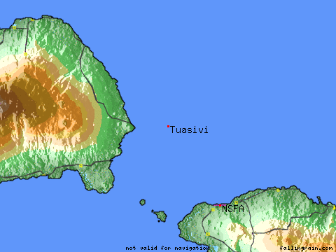
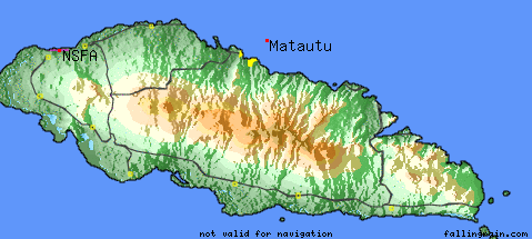
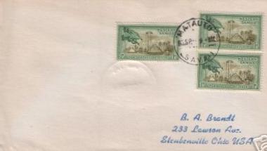
mappa isola Tuasivi fra Savai e Upolu
Tuasivii isola delle Samoa
mappa isola di Matautu nelle Samoa di fronte ad Upolu
(Matautu è sia un'isola a nord che un paese nel sud)
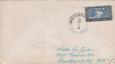
isola di Matautu con postmark di Savaii
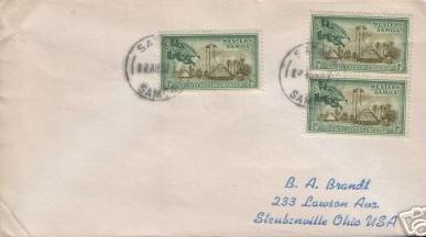
Sataua nell'isola di Savaii Samoa
AMERICAN SAMOA
American Samoa (Samoan: Amerika Samoa) is an unorganized, unincorporated territory of the United States located in the South Pacific Ocean southeast of the sovereign state of Samoa. The main (largest and most populous) island is Tutuila, with the Manu'a Islands, Rose Atoll, and Swains Island also included in the territory. American Samoa is part of the Samoan Islands chain, located west of the Cook Islands, north of Tonga, and some 300 miles (500 km) south of Tokelau. To the west are the islands of the Wallis and Futuna group. The 2000 census showed a total population of 57,291. The total land area is 200.22 km² (77.305 sq mi).
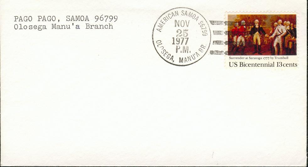
Trattandosi di territorio statunitense i francobolli usati sono quegli degli USA. Ci sono dei pre-cancel con la sigla Samoa e i CAP sono americani (es. la capitale Pago Pago ha il 96799):
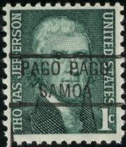
pre-cancel di Samoa Pago Pago
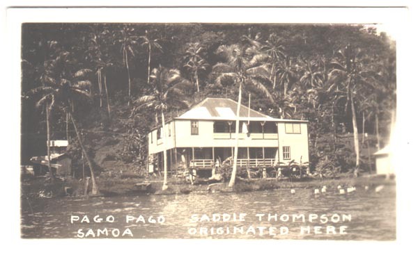
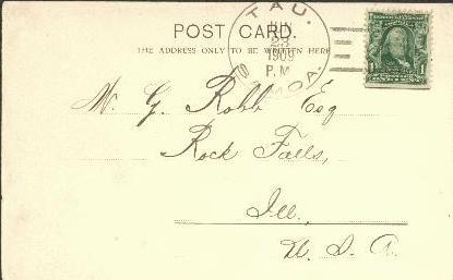
vecchia postcard di Pago Pago* del 1913
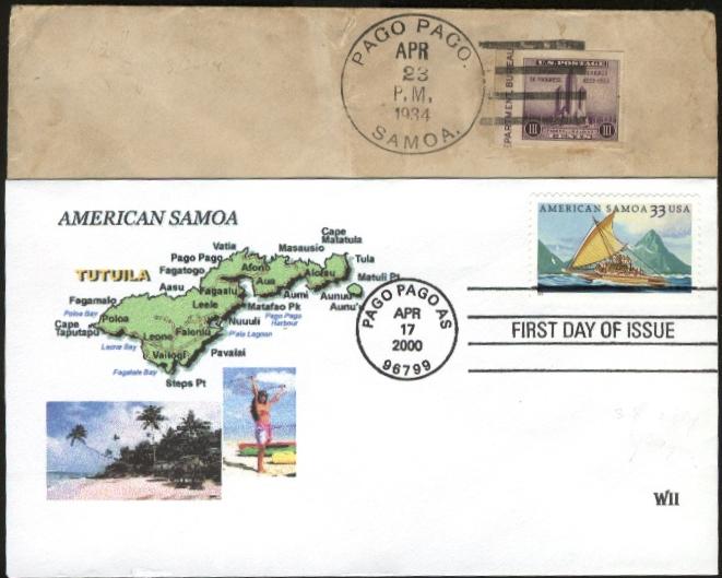
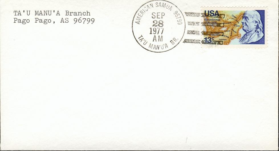
due cover con annullo di Pago Pago, su bolli USA nel 1934 e nel 2000
il dentello del 2000 commemora le "American Samoa"
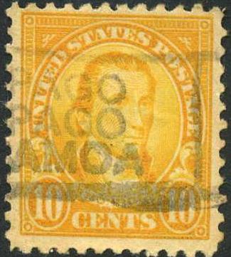
un francobollo USA del 1922 con annullo Pago Pago in riquadro
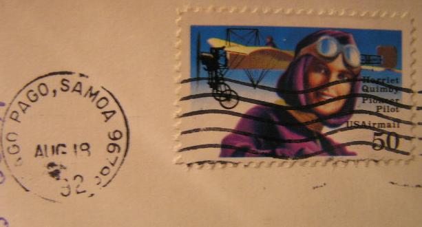
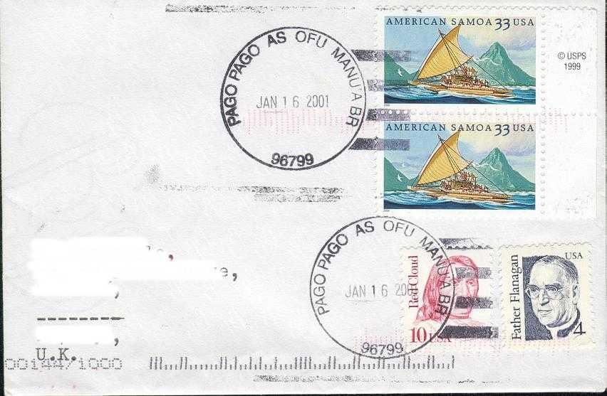
infine un altro annullo recente di Pago Pago 96799 American Samoa
L'isola principale di Samoa è Tutuila, vi sono poi le Manua islands di Ofu, Ta'u, Olosega. Ci sono anche Rose atoll e la più lontana isola di Swains.
Ringrazio l'amico Eric B. per le belle cover che mi ha mandato con interessanti annulli delle Samoa americane.
Ecco alcune sue informazioni sugli annulli:
Annulli delle isole Manua:
TAU postmark 23 giugno 1909 a 500 $ in offerta su e_Bay*
Tau island nelle Manua
Ofu island, Samoa statunitensi, con anche Olosega island sullo sfondo (grazie a maupiti):
Ofu island American Samoa e Olosega di fronte
Ofu island nelle Manua
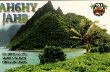
OFU MANUA* islands American Samoa in una QSL card del 2002
Olosega island nelle Manua
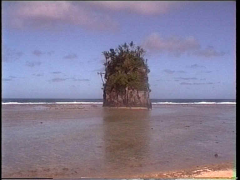
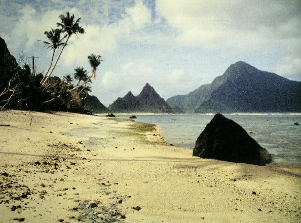
particolare dell'isola di Tutuila Samoa US: flower Pot Rock or Fatu rock
una cover 1936 delle Samoa: l'isola di Tutuila la più vicina a Rose island (vedi più sotto)
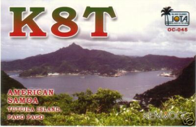
ecco una QSL del 2002 dell'isola di Tutuila* nelle Samoa
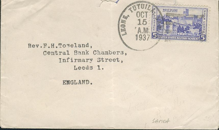
Tutuila island porto di Leone
altro annullo di Leone come Western district a Tutuila
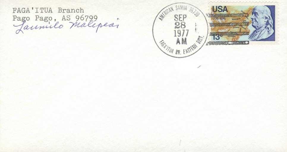
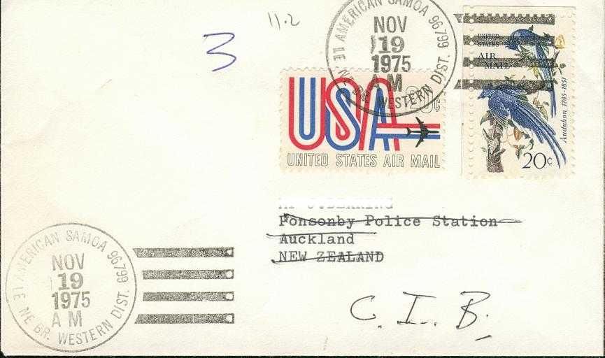
Faga I Tua o Eastern district a Tutuila
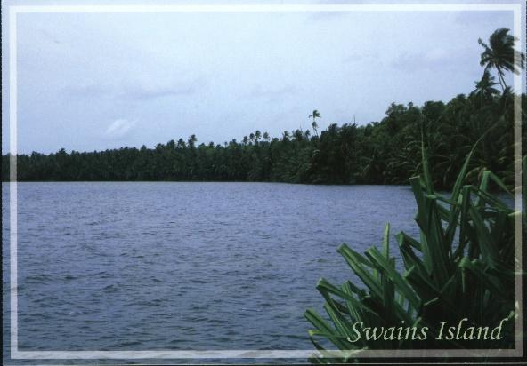
Un'altra isola sperduta, ma con una storia decisamente migliore è l'isola di Swains geograficamente nelle Tokelau (external territory della Nuova Zelanda). Vedi info generali al link: http://www.janeresture.com/tokelau_islands/swains.htm
L'isola ha anche altri nomi come: Olosenga (or Olohega), Quiros Island, Gente Hermosa, and Jennings Island, assegnateli nel tempo da vari esploratori.
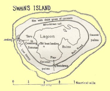
mappa dell'isola di Swains
Quest'isola è stata abitata da un massimo di un centinaio di nativi e la posta è molto scarsa, attualmente ci sono solo 14 persone... Grazie a Joel possiamo vedere una bella cover:
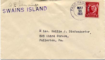
lettera del 1931 da Swains island, con timbro lineare agli USA via Pago Pago (Samoa)
altre cover di Joel a questa pagina: http://www.jrsportfolio.com/phila/uspi/uspi.htm
Un'altra cover di Swains in fotocopia con commento:
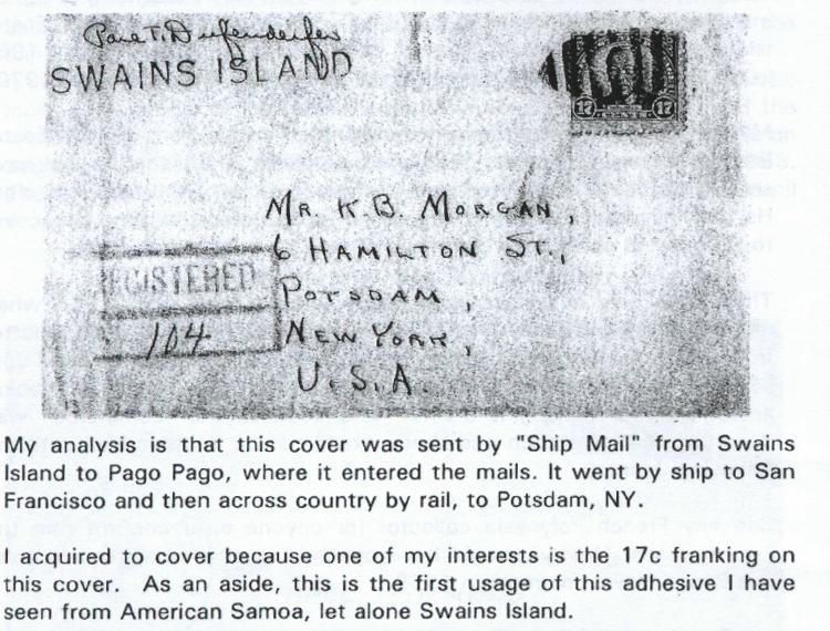
rara cover dell'isola di Swains, per concessione della rivista "Pacifica"
ma posso mostravi anche una rara postcard di Swains island:
Swains island (managed by American Samoa Marine& Wildlife Resources Office)
geograficamente appartiene alle Tokelau (dip. Nuova Zelanda). Attualmente ha 14 abitanti
Veniamo anche a Rose atoll o Rose island, che possiamo annoverare fra le isole estreme. Si tratta di soli solo 20 acri di terreno e 1600 di laguna, gestite dal U.S. Fish&Wildlife Service e governate dalle Samoa:
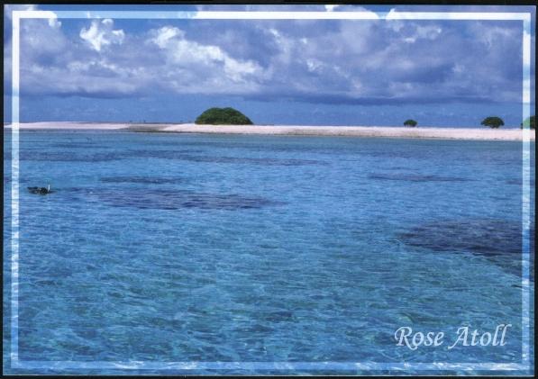
Rose atoll a 160 km dall'isola di Tutuila (Samoa americane)
Esistono anche annulli di Rose island, fatto dalla nave USA Ontario nel 1939 quando vi sbarcò:
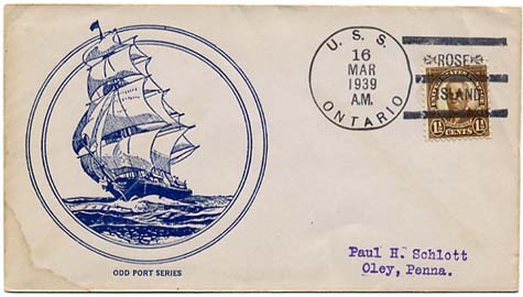
Rose island 1939: passaggio della nave Ontario (grazie Joel!)
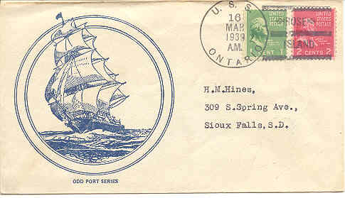
wow wow... Rose island 1939: ho trovato un'altra cover sempre della U.S.S. Ontario!

pagina da completare
------------------- °°°°°°°°°°°°°° --------------------
Mi scuso per eventuali imprecisioni, infatti, per risparmiare tempo, mi sono affidato solo alla mia memoria. Per certo posso fornire le fonti - sicuramente più attendibili di me - da cui ho tratto le varie informazioni. Se volete approfondire i vari argomenti, contattatemi
P.S. Su questo sito potete vedere immagini, articoli e approfondimenti ai temi discussi nei miei messaggi per il forum Filatelia e Francobolli.
Chi fosse interessato ai bolli della seconda guerra mondiale, a quelli dei prigionieri di guerra o di propaganda psicologica, alla resistenza, nonché alla storia contemporanea, incluse le missioni di pace italiane nel mondo e quelle scientifiche al polo sud, può visitare le oltre 500 pagine, in italiano ed in inglese, del sito, cliccando semplicemente sul tasto "Iniziale" qui sotto.
Gli altri tasti aiutano la navigazione all'interno di questa sezione "le storie dietro i francobolli" e "Curiosità filateliche". Precisamente: il sommario riporta gli argomenti trattati in ogni pagina; i tasti dall' 1 al 96 aiutano ad accedere direttamente alle prime xx pagine (12 per volta) ed infine c'è il link alla corrispondente pagina/pagine del Forum di F&F in cui lo stesso "topic" è stato discusso.
![]() NOVITA': Se cercate uno specifico argomento ed il Sommario
non è esauriente, potete provare con il nostro motore di ricerca. Esso funziona
all'interno del sito, e può essere utilissimo. Basta scrivere la
parola che si cerca, nel rettangolo qui sotto e cliccare a destra su "find".
NOVITA': Se cercate uno specifico argomento ed il Sommario
non è esauriente, potete provare con il nostro motore di ricerca. Esso funziona
all'interno del sito, e può essere utilissimo. Basta scrivere la
parola che si cerca, nel rettangolo qui sotto e cliccare a destra su "find".
la ricerca può essere fatta con una singola parola, con più parole ed anche con un * alla fine di una parola se si vuole interrogare sia il singolare che il plurale di una parola. Per esempio facendo la ricerca con la parola mission* si cercano tutte le pagine del sito, che contengono le seguenti parole: missione, missioni ed anche mission, e missions, etc.
NOVITA'
![]() QUI LA SEARCH ENGINE per ricerche all'interno di tutto il sito:
QUI LA SEARCH ENGINE per ricerche all'interno di tutto il sito:
N.B. Le schermate sono state ottimizzate per video a 17 pollici e collegamento ADSL, per cui molte righe ed immagini potrebbero risultare distorte, spostate o lente a scaricarsi, su altri schermi o computer con vecchi modem. Nel caso scrivetemi che provvederò a fare migliorie specifiche.
 |
 |
|
|